energy:geodata
energy:geodata helps you to precisely meet current challenges of the energy economy.
Based on existing databases and branch competence in the energy economy, trend:research offers with energy:geodata an encompassing serviceportfolio in the GIS sector - ranging from advice to data collection and acquisition to search and study of locations. By linking and visualisingdifferent layers of information with regards to space, complex spatial coherences can be displayed and analysed. By means of a cartographicprocessing of results, coherences become observable that could not be extracted from plain data charts. Therefore, GIS-systems form the base forefficient spatial planning processes and decisions. Via energy:geodata we conduct specific analysis with regards to your energy economy relatedquestions and visualise relevant spatial data. Examples include the search for suitable power generation sites or the illustration of existingfacilities.
trend:research has access to area-wide infrastructural information that can be utilised for answering energy economy related questions in aproject-based way. Encompassing data about land use, sites as well as grids and concessions enables us to give significant answers to complexquestions about the "how, where and what". By the cartographic processing of existing data analysis based on lines, surfaces and points is madepossible.
Background map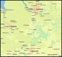 | Waters | Residential areas | Heat sinks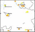 |
Any distance can be defined for line as well as for point objects.
 |  | ||
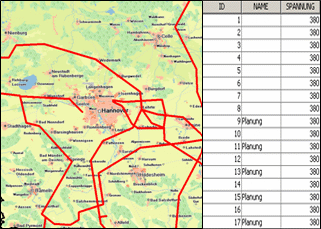
| 380 kV electric lines | including 15 km distance zone | Distribution stations | including 10 km distance zone |
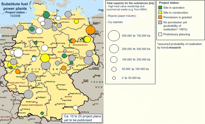
trend:research has access to extensive data about grids and concessions for electricity, gas and water in Germany and to data concerning commercial areas and municipal utilities as well as the following energy generation sites:
|
|
|
Potential sites for example for generation are detected by means of elimination and priority areas as well as on the grounds of maps indicating potential.
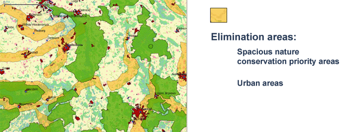
Percentage of wood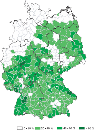 | Spacious nature conservation priority areas |
Further thematic maps are generated based on projects, for example about the spatial concentration of wind energy plants or in order to investigate the power plant fleet.
Process steps for the location search
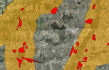
The identification of locations that are potentially suitable for the construction of a power plant is conducted systematically via a geographic information system that allows the visualisation and processing of space-oriented data.
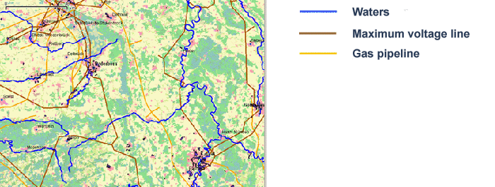
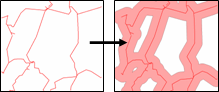
Around these available wide-area infrastructural lines distances are set according to defined distance criteria.
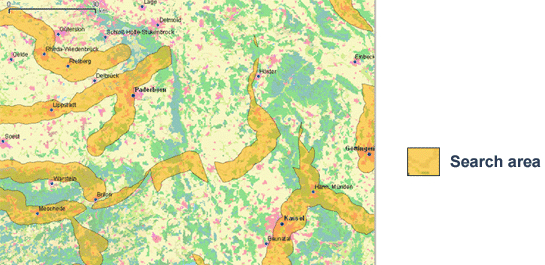
The resulting areas are blended with each other so that only those areas remain that comply with all criteria with regards to maximum distances (intersection). These areas define the search areas that fit all three distance criteria. In the further processing the search areas are reduced by those areas that are considered as elimination areas. By taking out elimination areas, that is areas where power plants probably can not be built, the search areas set by means of distance criteria are qualified further.
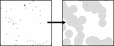
Of the industrial and commercial areas in Germany, all those that lie wholly or partially within one of the search areas specified by the before mentioned procedure are filtered and visualised for further processing.
The industrial and commercial areas selected for further detailed analysis meet the following criteria:
- Maximum Voltage line within max. 15 km
- Gas pipeline within max. 20 km
- Waters within max. 5 km
- Outside big nature conservation areas
- Outside urban areas
The following process step is the selection according to proximity to cities, size, open spaces.